Practical guide · Chulilla (Valencia) Chulilla and the Charco Azul
How to get to the Charco Azul, whether you can swim there after the DANA floods, the hanging bridges trail, what you pay and where to park. All on one page, checked in November 2026.
Chulilla, the canyon village
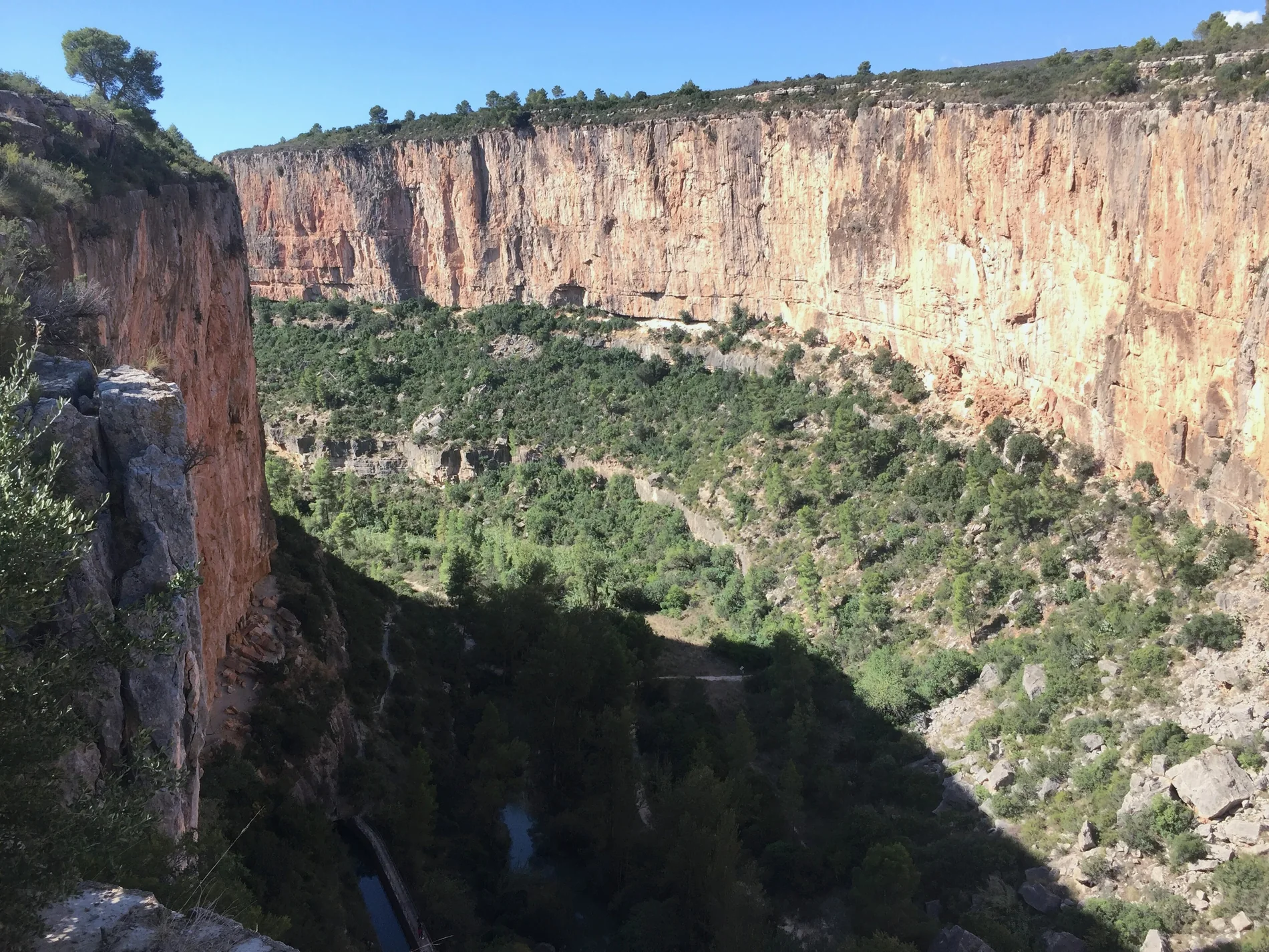
Chulilla is a village of just over 500 people in the Los Serranos area, about 60 kilometres from Valencia (45 minutes to an hour by car). Its white houses cling to the castle crag, of Islamic origin, and below it the river Turia has carved a canyon with vertical walls up to a hundred metres high.
Those walls have made Chulilla one of the best-known climbing areas in Spain. But most people come for two things you can do on foot and with no experience: walking down to the Charco Azul and the hanging bridges trail. Both start in the village and enter the Los Calderones Municipal Natural Area.

The essentials, in one minute
With information from Chulilla Town Council, the Valencian Mountain Federation (FEMECV) and Turespaña, checked in November 2026. Fees and trail conditions can change: check them before you go.
The Charco Azul: what it is and how to get there
Although it looks like a natural pool, the Charco Azul is man-made: it is the still water the river Turia forms behind an azud, a small weir. In fact, its name probably comes from that word, “azud”, and not from its colour: the water is usually emerald green rather than blue. A channel starts here that carries the water about 5 kilometres downstream and was used to generate electricity in the 20th century.
You get there on foot from the village along trail SL-CV 74, “El Charco Azul”. From the Plaza de la Baronía you walk down Calle San Juan and leave the village by Calle Charco Azul, down to the bottom of the canyon. If you do the full loop, the way back passes the Peña Judía and Trascastillo and climbs back up to the village. It is about 3.7 km, an hour and a half at an easy pace, suitable for almost everyone.
A warning: many websites say the trail to the Charco Azul is SL-CV 72. It isn't: SL-CV 72 is the Las Cuevas–Peñeta trail, a loop of just over a kilometre around the castle crag. The Charco Azul trail is SL-CV 74, as listed by the FEMECV.
Before going down, it is worth stopping at the Charco Azul viewpoint, where you can see the whole pool between the canyon walls.

Can you swim in the Charco Azul? Is it safe?
You can, at your own risk. After the DANA floods of October 2024, Chulilla Town Council explained in July 2025 that it had not closed the pool to swimmers, but that anyone who swims must take extreme care, because the state of the riverbed is unknown. The flood also swept away the wooden jetty and changed the course and flow of other swimming spots in the village, such as the Peña Judía and the Remanso de las Mulas.
The wooden walkway fixed to the wall of the pool is a different matter: it has been in ruins since the big floods of 1989, part of it is closed and you should not cross it or climb onto it.
As guides who work in rivers and canyons, this is the advice we always give:
The hanging bridges trail (Ruta de los Pantaneros)
This trail follows the path that the workers from Chulilla who built the Loriguilla reservoir in the 1950s walked every day. That is why it is called the Ruta de los Pantaneros (the reservoir builders' trail), or Los Calderones, after the area it crosses: a deep gorge with walls over 80 metres high, where the Rambla de Losa meets the Turia.
The bridges you cross today are made of wood and were finished in 2013, to replace the old ones that a flood had swept away. The first is the highest, about 15 metres above the river. The second is longer, with about 28 metres of walkway, and runs much closer to the water.
There are two ways to do it.
Short: from the start of the trail at Los Calderones, on the edge of the village, to the bridges and back. About 15 minutes each way, with quite a few steps. Ideal with children, taking care on the first 50 metres, which are the trickiest.
Full: to the Loriguilla reservoir and back the same way. About 9-10 km, 3 to 4 hours and some 300 metres of elevation gain. There is little shade: in summer, set off very early.
Entry to Los Calderones costs a fee of €1 per person, and it is very busy at weekends and on public holidays. Spring and autumn are much better for walking than the height of summer.

Near Chulilla: adventure with a guide
We don't run activities in Chulilla, but we do in the same Los Serranos area, where we guide two very different via ferratas.
El Remedio via ferrata, in Chelva: next to the Sanctuary, with views of the sea. Intermediate, with a harder option. From €55.
La Mulatica via ferrata, in Andilla: on red sandstone (rodeno) and away from the crowds. Intermediate, about 3 hours. From €55.
Both come with a qualified guide and all the gear included, and no experience is needed. If you want to choose at your leisure, see our guide to via ferratas in Valencia. And if you are looking for more places to swim, see the one on natural pools in Valencia.
Frequently asked questions about Chulilla and the Charco Azul
What people ask most before going. If you'd like to do a via ferrata nearby, message us on WhatsApp.
Can you swim in the Charco Azul in Chulilla?
Yes, at your own risk. The Town Council has not closed it, but since the DANA floods of 2024 it asks people to take extreme care because the state of the riverbed is not well known. Don't cross the wooden walkway on the wall: it is in ruins.
Is it dangerous to swim in the Charco Azul?
It is a river pool with no lifeguard. The risks are those of any river: jumping without checking the depth, cold water and swimming when the river is high. If you follow the advice in this guide and don't go alone, it is a relaxed swim.
How do you get to the Charco Azul?
On foot from the village, along trail SL-CV 74, which starts at the Plaza de la Baronía. You walk down Calle San Juan and Calle Charco Azul to the bottom of the canyon.
How long does it take to get to the Charco Azul?
The full loop, out and back via the Peña Judía, is about 3.7 km and an hour and a half. Just walking down to the pool takes much less.
Do you have to pay to see the hanging bridges?
Yes: entry to the Los Calderones natural area costs €1 per person. Children under 10, over-65s and registered residents of Chulilla don't pay. The municipal car park costs an extra €4 a day per car.
Where do you park in Chulilla?
In the municipal car park next to the CV-394 road, on the edge of the village, near the start of the hanging bridges trail. At weekends it fills up early.
Can you go with children?
Yes. The Charco Azul trail is suitable for families, and the hanging bridges are about 15 minutes from the start of Los Calderones. With children, take care on the first stretch of the bridges trail and on the steps.
Can you bring a dog?
Yes, always on a lead. From November to April keep an eye out for pine processionary caterpillars, which are dangerous for dogs.
Why is it called Charco Azul?
According to the most common explanation, the name comes from “azud”, the small weir that forms the pool, and not from the colour: the water is usually emerald green.

How about a via ferrata after the Charco Azul?
El Remedio, in Chelva, or La Mulatica, in Andilla, with all the gear included. Message us with the date and number of people and we'll confirm straight away.